The Future of Roberts Bay
News Feature
An in-depth look at the environmental crisis facing one of Sidney's most important ecological areas and the complex challenges in protecting it.
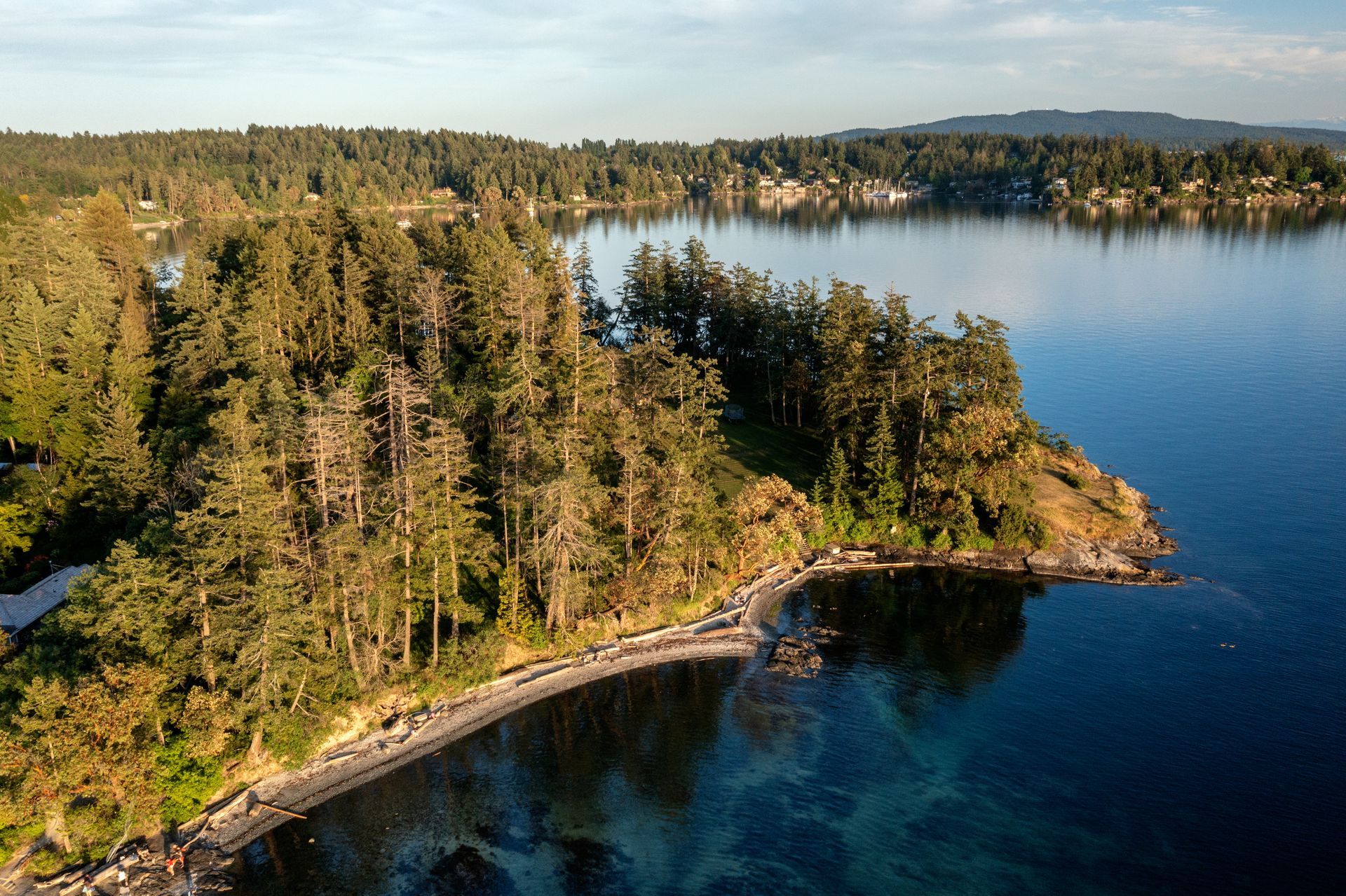
Roberts Bay, nestled within the traditional territory of the W̱SÁNEĆ people, is one of Sidney's ecological treasures. This semi-enclosed bay on the Saanich Peninsula is part of the Shoal Harbour Migratory Bird Sanctuary and the Sidney Channel Important Bird Area, representing a crucial intersection of natural and urban environments. Its shoreline, characterized by rocky outcrops and diverse beach materials, supports remnants of the rare Coastal Douglas-fir ecosystem, including Garry oak and arbutus trees.
A Rich Ecological Heritage
Despite ongoing urban development and frequent boat traffic, Roberts Bay continues to support an extraordinary diversity of wildlife. The area serves as a critical habitat for a remarkable array of bird species, highlighted by the presence of Pacific Great Blue Herons, which hold special status as a Species at Risk. The Bay's waters and surrounding regions teem with over 40 species of marine birds, while the upland areas host an equally impressive collection of more than 40 species of passerine birds, noted for their perching behaviour. The waterfront attracts a diverse range of waterfowl, including the distinctive Bufflehead, Common Goldeneye, and three Merganser species. Enhancing this rich tapestry of avian life, various shorebirds inhabit the edges of the Bay, including Black Oystercatchers, Black-bellied Plovers, and Black Turnstones, while both common and rare gull species can be observed, particularly the less frequently seen Heermann's and Bonaparte's Gulls.
The Bay's nearshore reefs provide essential roosting sites for these birds, while its mudflats, exposed at low tide, support a productive marine ecosystem of clams, worms, sea lettuce, and eelgrass.
The Critical State of Mermaid Creek Salt Marsh
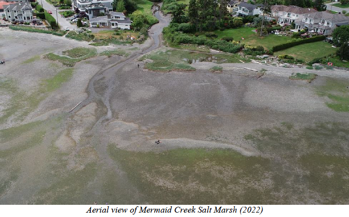
At the heart of this ecosystem lies the Mermaid Creek Salt Marsh, a specialized habitat designated by the Town of Sidney as an Environmentally Sensitive Area. This compact yet vital ecosystem, dominated by pickleweed and saltgrass, serves as a natural powerhouse, fulfilling four key environmental functions: capturing and storing carbon from the atmosphere, filtering water as it flows through the marsh, providing essential living space for local fish and wildlife, and acting as a natural barrier that protects the shoreline from erosion and storm damage.
However, the marsh faces a severe crisis. Studies reveal that over 70% of its area has been lost to erosion in the past 60 years, with losses accelerating dramatically since 2005. Current data shows approximately 30% of the remaining marsh area is eroding annually, most probably due to:
- Historical modifications of natural sediment delivery systems
- Increased erosion forces driven by climate change
- The incorporation of Mermaid Creek into Sidney's stormwater system and
- Coastal squeeze from hardened shorelines
The Failed Restoration Attempt
In response to this crisis, the Peninsula Streams Society (PSS) initiated a restoration initiative supported by various organizations including the World Wildlife Fund. Their comprehensive plan addresses the challenge directly with four major components: they propose constructing protective rock crescent headlands standing one meter tall to guard against wave damage, importing 4,000 tons of carefully selected marsh and beach materials to restore the habitat, replanting the area with native vegetation including pickleweed and saltgrass, and maintaining vigilant oversight through continuous monitoring to refine their approach as needed.
Despite securing approval from Transport Canada under the Navigable Waters Protection Act, the project faced an unexpected obstacle. One or more upland property owners objected to the project's potential infringement on their right to unimpeded access to navigable waters. Unable to obtain consent from five property owners within the funding deadline, project partners were forced to cancel the initiative.
The Looming Threat of Climate Change
Climate change and rising sea levels present increasing threats to Roberts Bay's future, as highlighted in the Capital Regional District's 2021 flood mapping report. The study reveals a concerning outlook: existing salt marshes will confront deeper waters, while many properties are located squarely within projected flood zones. Many homes are already positioned too close to the natural boundary, with grandfathered setbacks, complicating preservation efforts. This situation necessitates careful planning, as future developments will require significant elevation increases to meet Flood Construction Level requirements. Perhaps most alarming is the risk of "coastal squeeze," where marsh habitat is trapped between encroaching seas and fixed shoreline development leaving it no place to survive.
Regulatory Complexity
The effort to protect Roberts Bay is entangled in a maze of overlapping jurisdictions with gaps in authority. The federal environmental agency lacks direct power to act despite Canada's commitment to international wetland protection through the Ramsar Convention—a global accord on the conservation of wetlands to which Canada has been a signatory since 1992. British Columbia's approach to wetland conservation is fragmented, with protection measures scattered across various laws instead of under a single, comprehensive framework. There is a key gap in protection of coastal salt marshes even where the Province owns the foreshore they are on. Local officials have a clear planning mandate but have limited ability to implement solutions without senior government as a partner. At the same time, private property rights can sometimes conflict with efforts to preserve this vital ecosystem. This regulatory patchwork renders Roberts Bay vulnerable, underscoring the challenges of protecting important coastal habitats in urban areas.
Path Forward
While local government cannot solve this problem independently, that doesn’t mean there is nothing local government can do. Some examples of potential actions include:
- Development of a sea level rise adaptation plan
- Creation of a local area plan for the Roberts Bay ESA
- Internal workshops with multiple stakeholders to identify options
- Updating the Official Community Plan to strengthen environmental protections
- Seeking provincial legislation changes to support local government adaptation plans
- Requesting dedicated funding for conservation efforts
- Engaging with federal and provincial agencies
- Working with conservation organizations
- Building consensus among property owners
The future of Roberts Bay depends on coordinated action by government bodies, property owners, and conservation groups. The Town of Sidney's support in recognizing this as a priority will be crucial in achieving a solution.
Sidney Council has referred this topic to its Strategic Planning Workshop to be held in late January, 2025.
This article is based on a discussion paper by Peter Wainwright, Peninsula Affairs, Radio Sidney. For more information about conservation efforts in Roberts Bay, contact the Peninsula Streams Society or SeaChange Marine Conservation Society.


